For this week's assignment, I had to hand it in late due to the airshow that required me to work all weekend. A video of the weekend's events can be found here for your leisure.
My candidate of choice was the Boeing/Insitu designed ScanEagle.
The Scan Eagle is a medium altitude long endurance UAV with a sensor payload for ISR missions.
It has a max speed of 126 km/h and max altitude of 16,000 ft. The nose turret of the ScanEagle houses its sensors which consists of an electro-optical and infrared sensor to provide detailed imagery and video of how to 640 x 480 pixels. The sensor payload is also able to be customized with other devices such as a CBRN sensor or magnetometer. A recent study of maritime fauna also installed a DSLR camera as its payload proving the modular and inter-operable design of the ScanEagle. With this study, I also inferred that commercially available SD cards were compatible data storage devices.

The onboard data recorded is recorded in NTSC video which is also convertible to MPEG 2 file format. The Local Data Sets are encoded in ISO7 format and its metadata is transmitted via UHF 900 MHz datalink and a 2.4 GHz S-Band down link to the ground control station for line-of-sight ranges. For BLOS ranges, the Iridium Satellite system is a viable alternative to transfer data up and down stream to the ground control station.

The architecture used for the datalink is a common centralized concept which allows only one ScanEagle to transmit/receive information to the ground control station.
A future recommendation would be as per Lim's research at Naval Postgraduate School in 2007 which is to leverage the use of wireless cards to integrate a mesh architecture. I also believe that 4G-LTE datalink capabilities would be able to advance the ScanEagle into the next generation. A combination of these two recommendations would allow the ScanEagle System as a whole (qty 4 UAVs, GCS, Launcher and Recovery System) to have expanded ISR coverage and also range since the backbone/clusterhead UAV would act as a rearguard to relay information among the swarm/mesh to the ground control station.
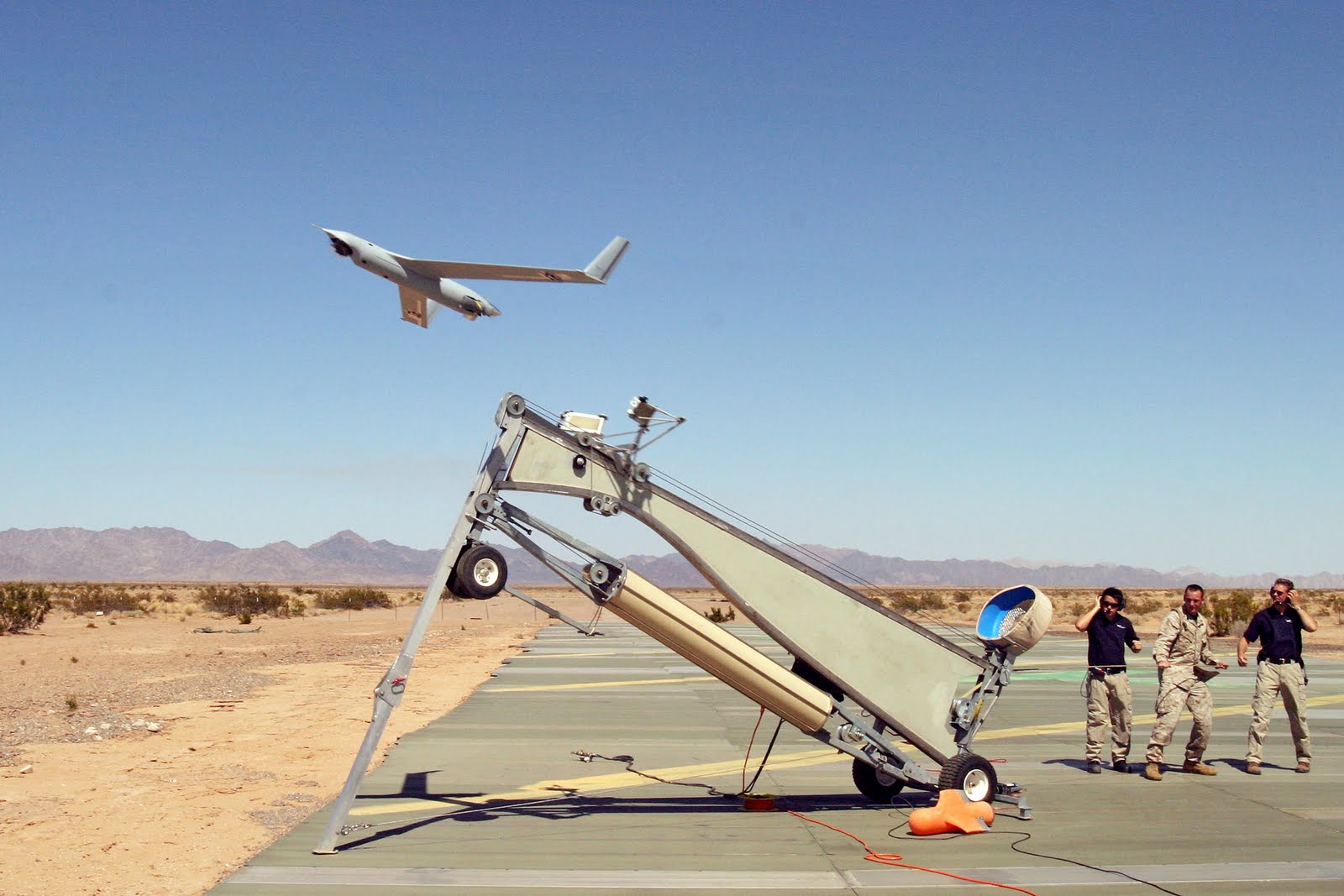 |
| ScanEagle launched from the Mark-4 System |
No comments:
Post a Comment